Arctic and boreal regions have experienced unprecedented changes in recent decades as the result of climate change. Increasing air temperatures have led to widespread warming and degradation of permafrost, significant shifts in vegetation composition and productivity, and increases in disturbance frequency and extent - all of which can have profound impacts on ecosystems and human populations across the globe. Research completed by RSGAL/NRSM doctoral graduate Dr. Neal Pastick combined field measurements, time series analyses, climate reanalysis data, and remote sensing into an integrated modeling framework. The primary goal was to improve understanding of how and why globally significant permafrost landscapes are changing by means of: (1) Characterizing climate, permafrost, wildfire, and vegetation dynamics that exert strong controls on energy, water, and biogeochemical cycling; (2) Quantifying underlying drivers of change related to contemporary trends in land and water surfaces observed by remote sensing; and; (3) Providing novel approaches and baseline information to fill critical observational gaps identified by the remote sensing community and permafrost and ecosystem scientists. See Neal's dissertation here.
RSGAL/NRSM Master's student Jeff Disbrow's thesis project focused on detection of permafrost degradation by retrogressive thaw slumps in Arctic thermokarst. Retrogressive thaw slumps (RTS) are a specific form of permafrost degradation that occur on hillslopes after the exposure of ground-ice in permafrost soils. Ground-ice may be exposed through wildfire, channelized flow of surface water, precipitation, and/or active-layer detachments. Retrogressive thaw slumps can subsequently form if there is sufficient slope and melting of ground-ice to result in instability and downward subsidence. The accuracy of predictions regarding the rate and magnitude of the impacts of permafrost degradation would benefit greatly from widespread quantification of the size and distribution of thermokarst landforms. In-situ measurements of permafrost degradation features have been limited due to the remoteness of many of the landscapes they occur on. Remote sensing provides a method by which permafrost degradation features may be identified at the landscape scale.
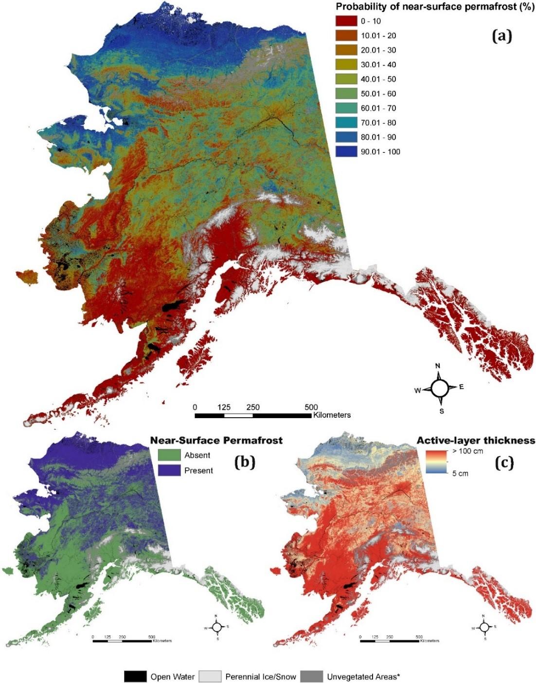
Modeled maps of (a) probability of near-surface (within 1 m) permafrost (NSP), (b) presence-absence of NSP, and (c) active-layer thickness (cm) within Alaska. Map (b) was derived from map (a) using a 50% probability threshold. Figure from Neal Pastick's dissertation.